Chippewa Valley Trail Maps
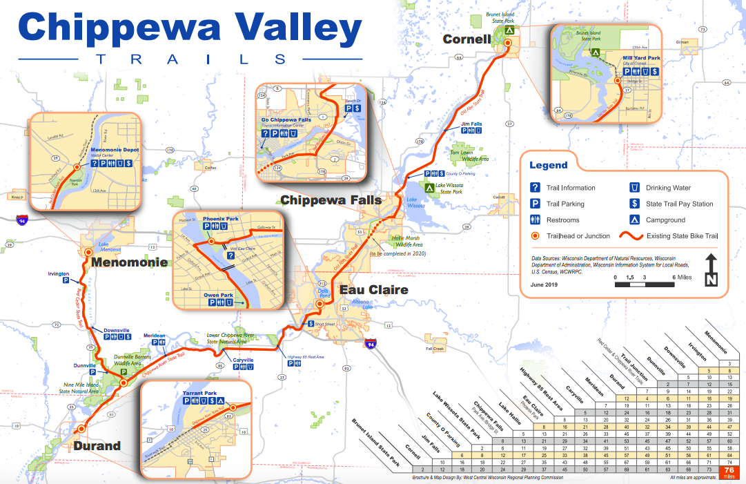
The Chippewa River State Trail kicks off at the confluence of the Eau Claire and Chippewa Rivers in downtown Eau Claire’s Phoenix Park, where visitors can access a walking labyrinth, amphitheater, farmers market, restrooms, parking, and the southwestern endpoint of the 28-mile Old Abe State Trail, which heads to Cornell. Heading southeast, your journey begins over a 500-foot-long trestle that used to carry train cars of the Chicago, Milwaukee, St. Paul and Pacific Railroad. The trail terminates at the Tarrant Park trailhead in Durand, approximately 6.5 miles past the junction of the Red Cedar State Trail. Here, you’ll find ample parking as well as a registration office for purchasing State Trail Passes. About a mile and a half farther west of Tarrant Park, Lower Chippewa View Park provides beautiful waterside views.
Click here > Google Maps - Chippewa Valley Trail Maps


Click here for the Chippewa Valley Trail System Map
Click here for Bike Trails of Chippewa Falls and Chippewa County